Personal - Professional - Pragmatic
Geographical Information Systems
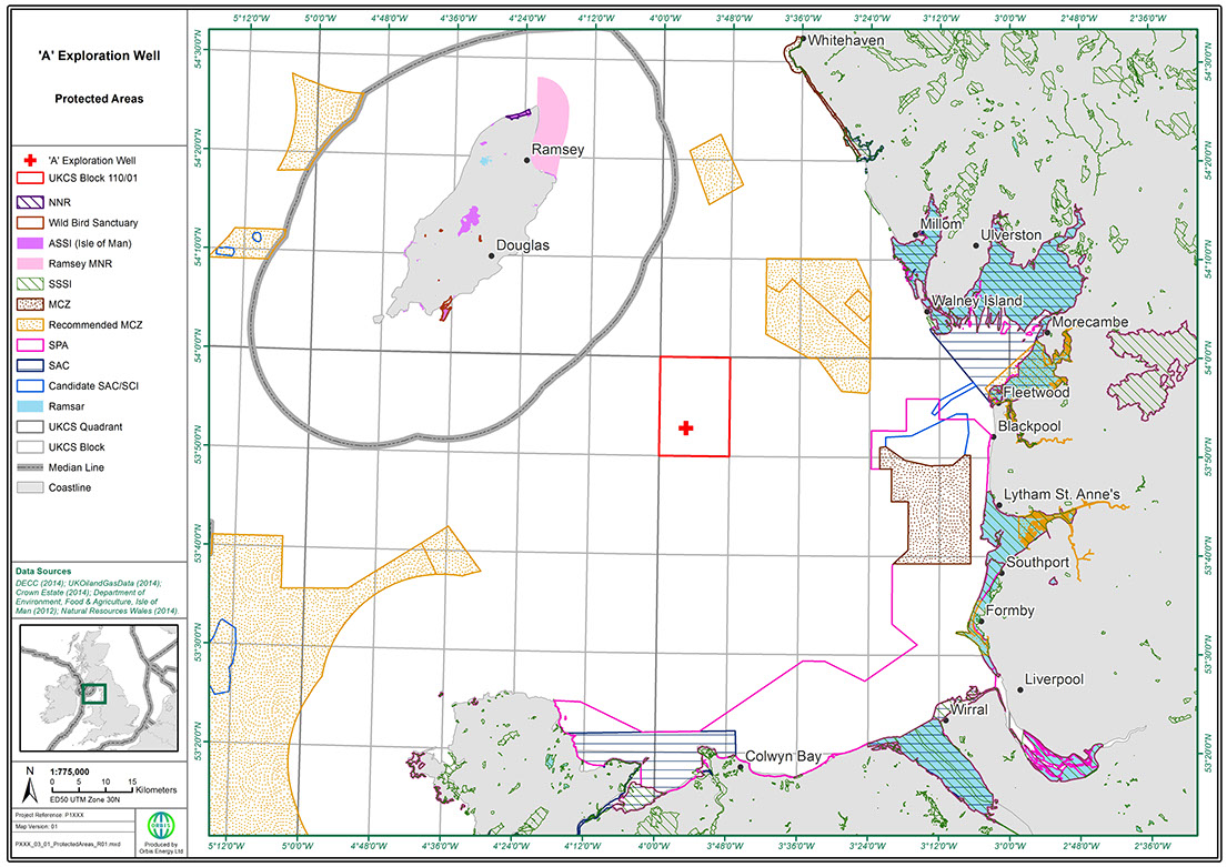
Orbis has in-house Geographic Information Systems (GIS) expertise allowing data capture and analysis, as well as general mapping to facilitate data presentation and support decision making.
Services
GIS facilitates the analysis, interpretation, investigation and management of geographically referenced information. Orbis uses the industry leading ESRI ArcGIS and holds extensive spatial environmental datasets for both the UK and international areas.
It is a useful tool for projects of all sizes and enables Orbis to:
- Maintain a geographically referenced database
- Investigate geographical data
- Conduct spatial analyses
- Create mapping graphics for reports, including ESIAs, permit applications and oil pollution emergency plans
Orbis Energy Limited
24 Neal Street
2nd Floor
Covent Garden
London
WC2H 9QW
Email: info@orbisltd.com